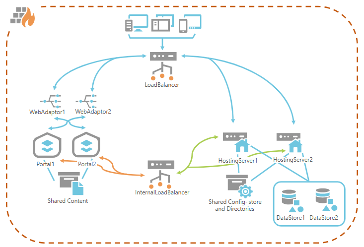
Empowering Your Geospatial Success with Innovation
Focusing on various geospatial analyses, infographics, environmental impact simulations, interactive maps, GIS automation, GIS Systems administration, and custom GIS solutions to support emergencies response, disaster preparedness, sustainable growth, and situational awareness. Inspired by Sustainable development goals our expert team turns complex data into actionable insights, empowering clients to make informed decisions.
ABOUT US
WHAT WE DO
At the forefront of geospatial innovation, we specialize in delivering cutting-edge GIS and remote sensing solutions tailored to the unique needs of the social, economic, and environmental sectors. Our mission is to transform complex spatial data into actionable insights that empower organizations to make informed, strategic decisions.
OUR SERVICES
Let’s Work Together On
ArcGIS Enterprise management service
ArcGIS Online management service
Geospatial Data & Analysis Management Services
Web and Mobile Mapping application development
Situational Awareness solutions
Remote Sensing Analysis and Imagery Services
Hydrological and Hydraulic Modeling Services
Geospatial Training and Capacity Building Services
GIS Augmented Capacity – Human Resource Surge Support
TECHNOLOGIES
Technologies We Are Passionate About
DOMAINS APPLICATIONS
Climate and Environment
Feasibility Studies
Disaster Risk Management
Urban Planning And Development
CLIENTS
400+
Project Completed
300+
5 Star Rating
350+
No Of Clients
25+
No Of Customers
Have a project in mind
We can help you bring your ideas to life. let,s talk about what we can build and raise together,.
- List Item #1
BLOGS

ArcGIS Enterprise Deployment Models: Architecture and Security Considerations
ArcGIS Enterprise Deployment Models: Architecture and Security Considerations ArcGIS Enterprise

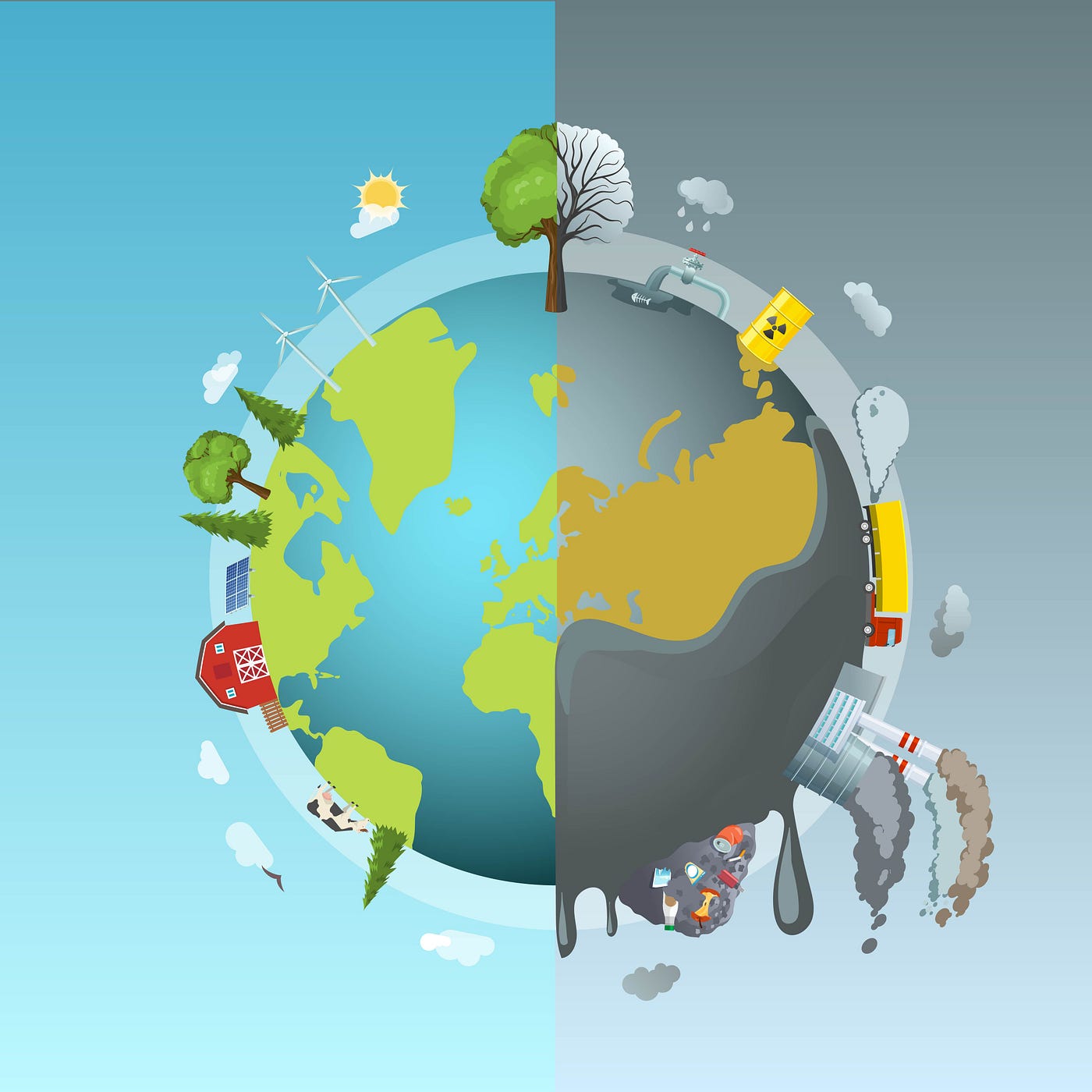
Extreme Weather Insights: An ArcGIS Dashboard for Climate Resilience
In an era of increasing climate volatility, understanding the patterns

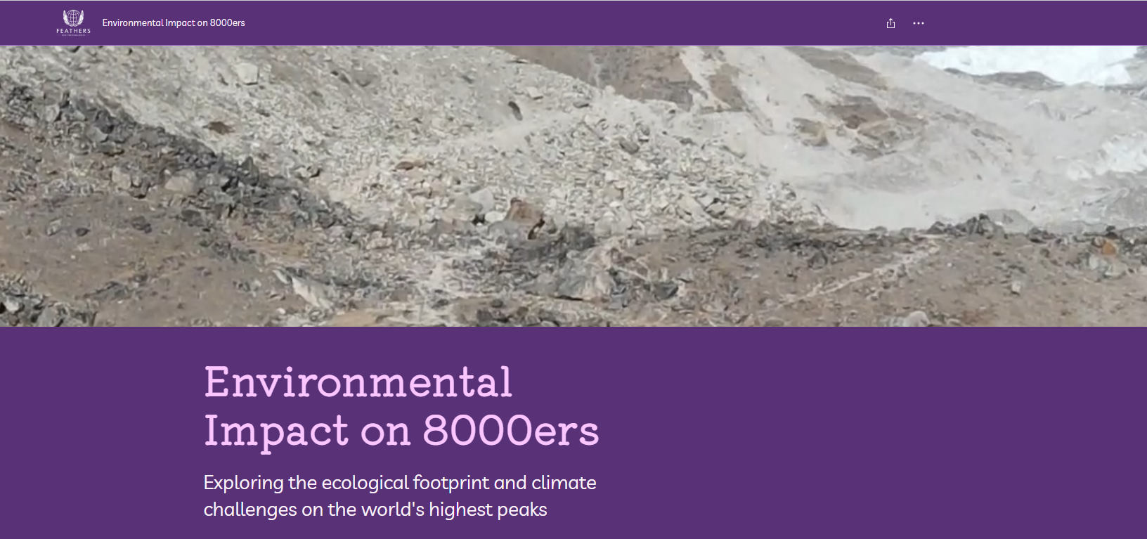
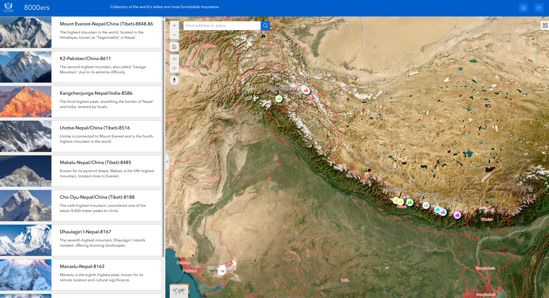
Environmental Impact on 8000ers: Exploring the Ecological Footprint and Climate Challenges on the World’s Highest Peaks through ArcGIS story maps
The fourteen 8000-meter peaks—known as the 8000ers—are not only mountaineering marvels

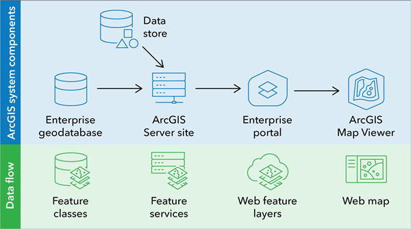
Best Practices for ArcGIS Enterprise Geodatabase Management
Managing an enterprise geodatabase within the ESRI ArcGIS platform requires
Discover the 8000ers: How GIS and ArcGIS Experience Builder Bring the World’s Highest Peaks to Life
The 8000ers—14 peaks soaring above 8,000 meters—are the highest mountains on

Transforming Data into Spatial Insights
Geographic Information Systems (GIS) is revolutionizing the way we analyze
NEWSLETTER
Subscribe to our newsletter to get latest updates